The Cleveland Trails Wayfinding Master Plan was developed to create a cohesive and intuitive navigation system for the city’s growing network of off-road trails and bikeways. As Cleveland continues to invest in these multipurpose trails, connecting users with the city’s neighborhoods, landmarks, and destinations has become essential. Guide Studio led a comprehensive wayfinding assessment and experience audit to understand user needs and design an effective sign program.
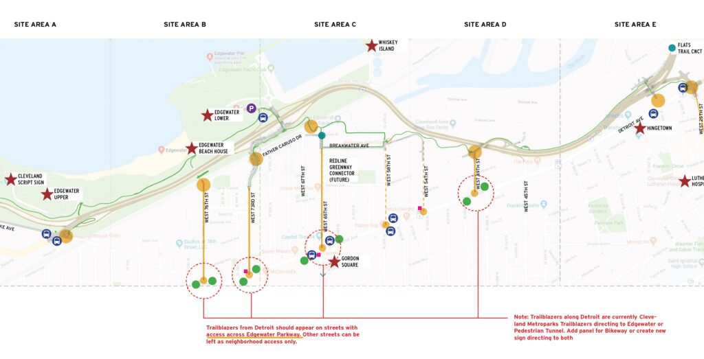
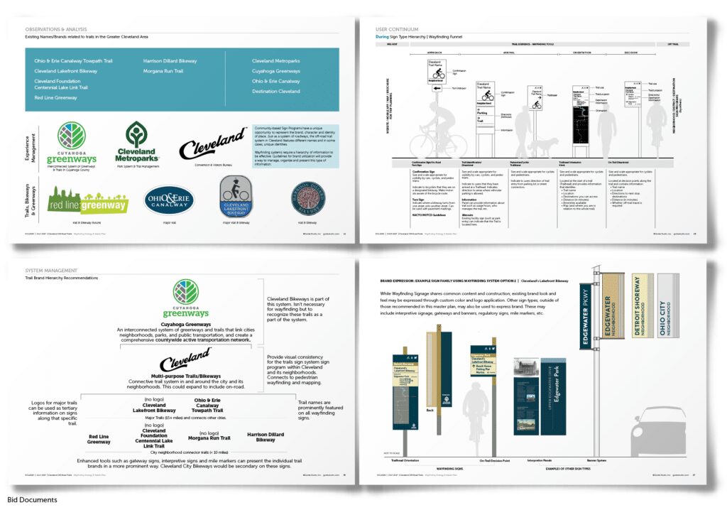
The project began by evaluating existing and planned trails, focusing on how people experience Cleveland from a new perspective—on foot or by bike rather than by car. Unlike traditional navigation methods, trails require distinct wayfinding solutions that account for different speeds of travel, levels of familiarity, and a variety of user types, including recreational cyclists, commuters, and tourists. Guide Studio developed a strategic framework to unify signage across Cleveland’s extensive trail system while maintaining the identity of individual routes.
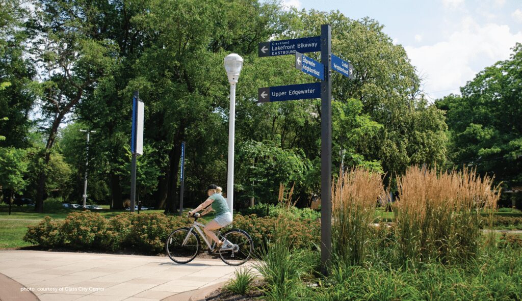
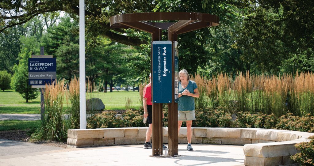
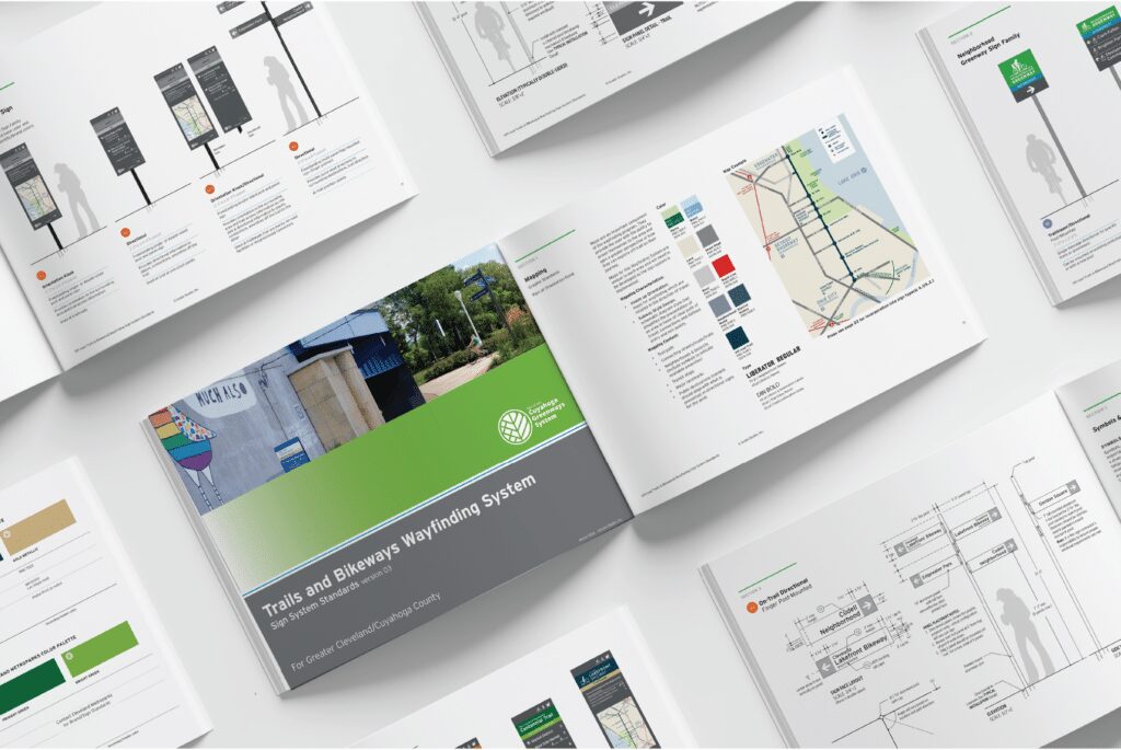
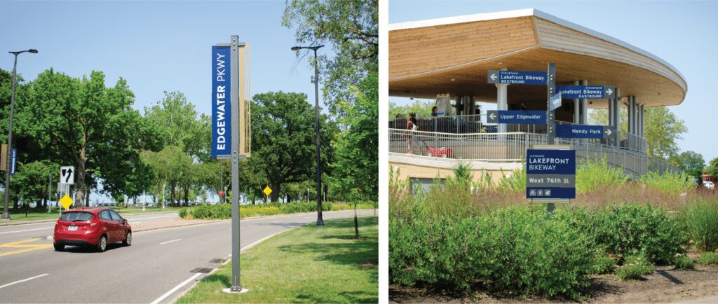
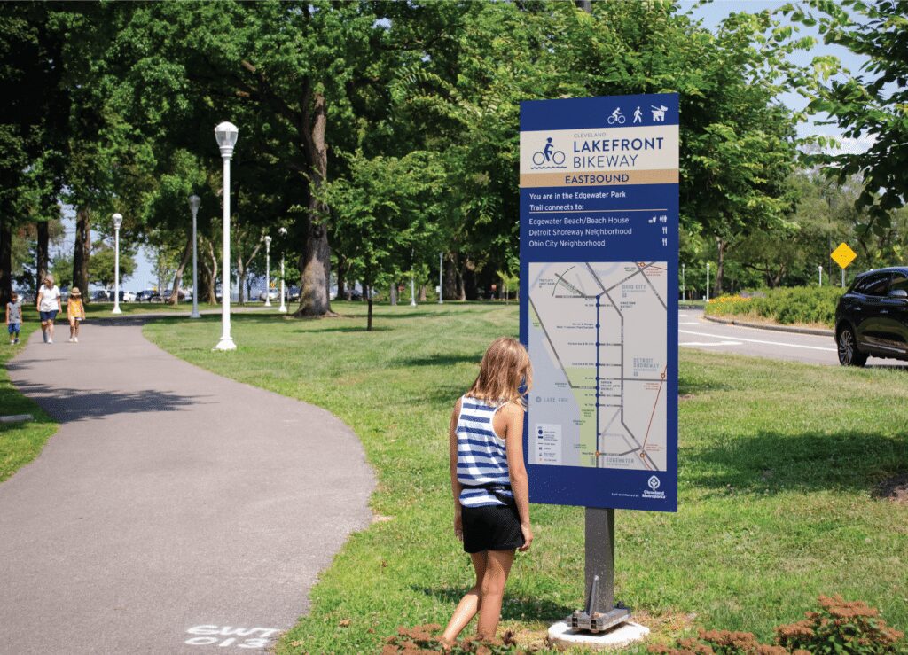
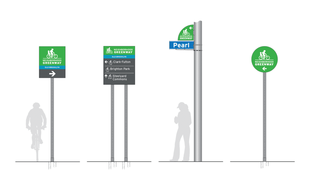
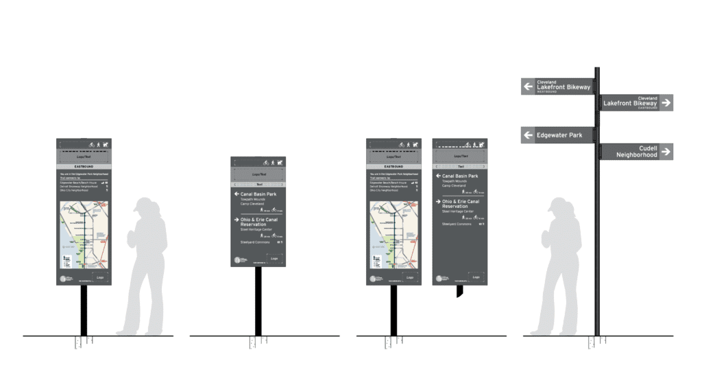
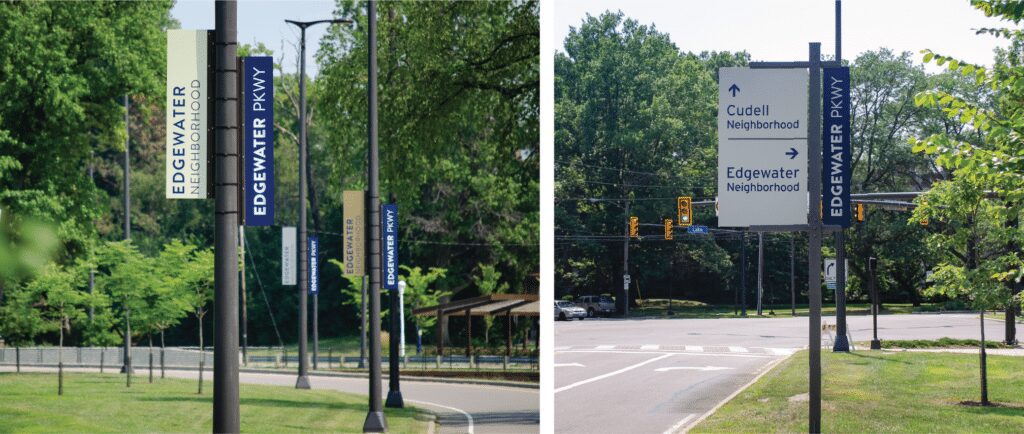
The sign program was piloted on the Cleveland Lakefront Bikeway to test effectiveness, clarity, and durability. This phase provided valuable insights that led to refinements before full implementation. A key outcome of the project was the creation of a Sign Standards Manual, ensuring consistency in sign design, placement, and messaging across the city and Cuyahoga County. The system includes orientation kiosks, on-trail directional signage, and neighborhood connectors, helping users navigate confidently while encouraging exploration.
Through collaboration with key partners, including Destination Cleveland, Cleveland Metroparks, Bike Cleveland, and municipal planning agencies, the wayfinding strategy ensures that Cleveland’s trail network is well-marked and a valuable tool for tourism, community connectivity, and economic development. The resulting sign system enhances the experience of Cleveland’s off-road trails, positioning them as an essential component of the city’s identity and transportation infrastructure.